Walking the Cotswolds: History, Law, and the Paths That Bind the Hills

Step onto ancient limestone ways and modern parish paths as we explore the history and legal status of public rights of way in the Cotswolds. Discover how Roman roads, wool merchants, enclosure, and twentieth‑century legislation shaped where you can walk, ride, and wheel today. Learn how the Definitive Map secures access, what different classifications allow, and how communities keep routes open. Share your stories from the Cotswold Way or hidden holloways, ask questions about obstructions or signage, and help protect these living corridors for future journeys.

Tracks Through Centuries

Roman lines and limestone ridges

Stand on the Fosse Way or trace Akeman Street near Cirencester, and you feel a Roman insistence on directness meeting the Cotswold love of contours. Beneath hedges and dry‑stone walls, older alignments persist, guiding feet and hooves toward springs, quarries, and guarded river crossings.

Parish ways, packhorses, and wool

Medieval worship and commerce stitched settlements together. Packhorses carried Cotswold wool toward Northleach and Burford, while bell‑ringers and mourners relied on church paths kept clear by custom. These lived itineraries created expectations of passage that later law recognised, albeit unevenly, through dedication, frequent use, and recorded acknowledgment.

Enclosure and the paths that vanished

Parliamentary enclosure redrew fields and sometimes quietly erased customary lines. Commissioners preferred straight boundaries, yet many ancient lanes survived through determined parish voices. Where records failed, fragments linger as holloways or green corridors. Today’s researchers turn tithe maps, awards, and recollections into evidence capable of restoring continuity.

From 1949 surveys to modern GIS

After the National Parks and Access to the Countryside Act 1949, parishes walked their networks, filled forms, and drew first maps. Decades later, scanned sheets and GIS portals let anyone overlay aerial imagery, tithe plans, and modern layers, revealing discrepancies, historic cul‑de‑sacs, and missing links worth investigating.

Modifying the record lawfully

Definitive Map Modification Orders under the Wildlife and Countryside Act rely on evidence, not convenience. Old highway status can be proven by consistent documents or twenty years’ uninterrupted use without permission and without secrecy. Success turns paper trails into lines on the ground, respected by neighbours and future surveyors.

What You May Do: Classes of Ways

Different classifications define who may pass and how. Footpaths welcome walkers; bridleways add horses and cycles; restricted byways include non‑mechanically propelled vehicles; byways open to all traffic can legally carry motors. Courtesy, control of dogs, and common sense ensure these rights coexist safely along narrow, centuries‑old corridors.

Footpaths and the art of considerate walking

On a footpath, the public may pass on foot, linger briefly, admire views, or take photographs. Keep to the line, close gates, and respect growing crops. Dogs should be under effective control, especially near livestock, ground‑nesting birds, or busy farmyards where sudden surprises unsettle everyone.

Bridleways, cyclists, and cantering etiquette

Cyclists have a right to use bridleways while giving way to walkers and horse riders. Soft verges, blind corners, and steep descents demand patience and spoken warnings. Riders cherish considerate behavior, and shared smiles rebuild trust where a ringing bell or skittish gelding once sparked awkward moments.

Byways, green lanes, and when engines must pause

Byways and green lanes tempt adventurous souls. Yet seasonal closures and Traffic Regulation Orders may limit motor use to protect surfaces, tranquility, or wildlife. Checking signage, council notices, and online orders prevents conflict, while quiet travel preserves rare plants, ancient banks, and the song of skylarks spiraling upward.

Care, Maintenance, and Responsibilities

Keeping routes open is a shared duty. Highway authorities maintain surfaces, bridges, and most signs; landowners keep stiles, gates, and vegetation in reasonable order. Obstructions, crops across paths, and intimidating notices are unlawful. Knowing timelines, responsibilities, and reporting channels transforms frustrations into swift, collaborative problem‑solving across parishes.

Ploughing, cropping, and keeping lines open

Cross‑field footpaths may be ploughed when necessary but must be reinstated within statutory deadlines and kept clear of crops to a walkable width. Headland paths should not be cultivated. Simple, timely action avoids complaints, enforcement, and bad feeling when harvest pressure meets weekend walkers seeking calm.

Gates, stiles, and the move toward accessibility

Modern access favors gaps and accessible gates over stiles, easing passage for families and those with limited mobility. Landowners can claim contributions toward structures, and authorities advise on designs. Clear waymarks at junctions prevent wandering, stray footprints, and avoidable damage to crops, dry‑stone walls, and sensitive wildflower margins.

Cotswold Way and the Web of Local Paths

The Cotswold Way ties escarpment viewpoints to market towns over more than one hundred miles, yet its magic depends on countless linking paths that feed villages, pubs, bus stops, and B&Bs. Understanding how local routes interact with the National Trail unlocks weekend loops, family ambles, and ambitious traverse plans.

01

A dawn above Cleeve Hill

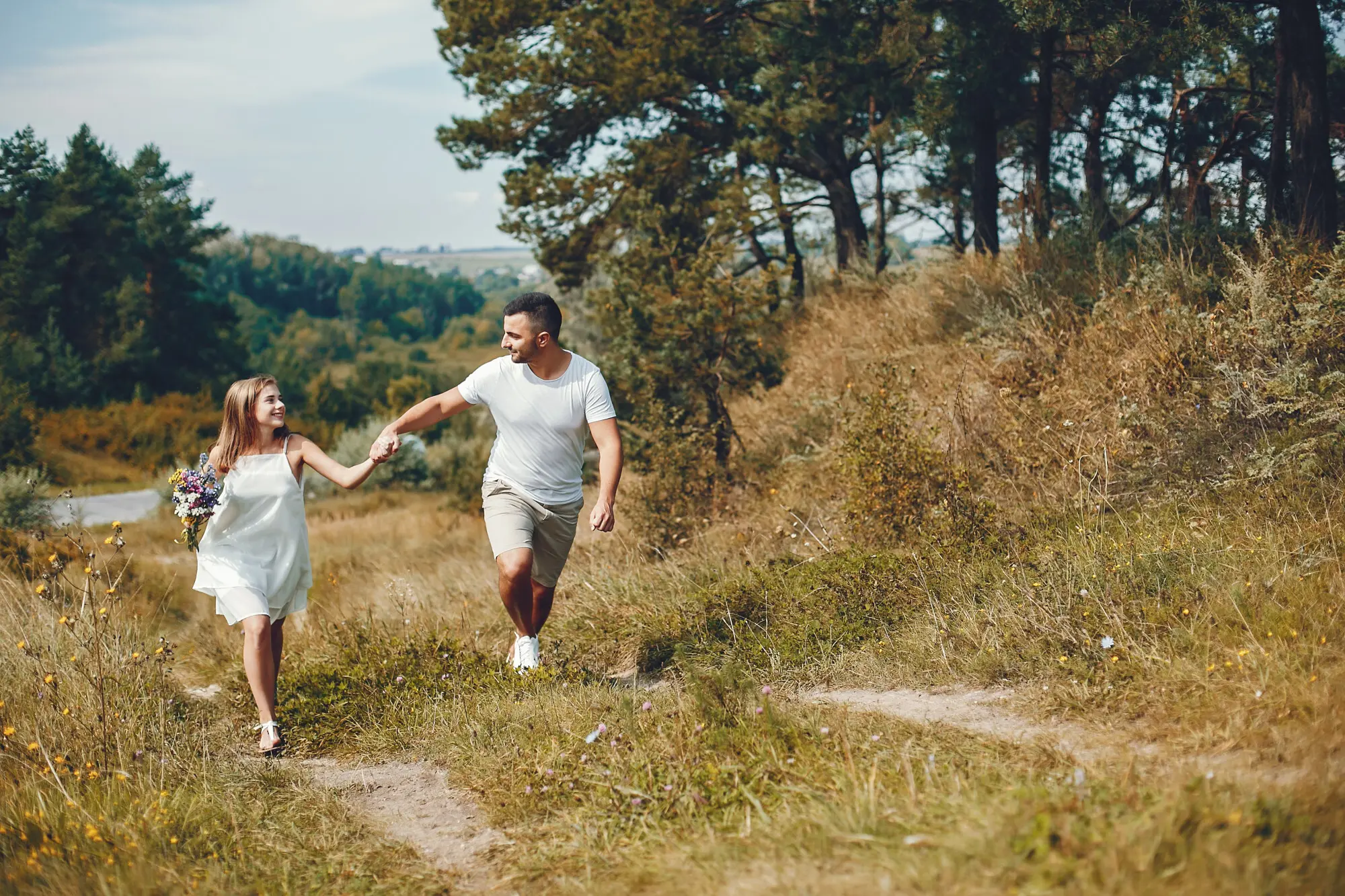
A summer dawn on Cleeve Hill reveals lark song, dew‑silvered grasses, and Bath stone glowing far to the south. A lone walker shares the ridge with two riders and a quiet runner. That unforced coexistence is the everyday miracle secured by humble legal lines on maps.

02

Volunteers who quietly keep paths alive

Volunteer wardens mend steps, trim brambles, and replace rotted fingerposts without fuss. Ramblers and local groups submit reports through handy apps, while parish path teams bridge boggy hollows with boardwalks. Their patient craft means children in trainers discover butterflies today, and elders return safely tomorrow for remembered views.

03

Seasons, lambing, and sharing fields kindly

Spring lambing and ground‑nesting birds ask for extra care. Keep dogs on leads where requested, avoid new crops, and steer clear of cattle with calves. Friendly gestures, thanks at gates, and unhurried pacing cool tempers quickly, preserving goodwill that sustains access long after bootprints fade.

Rescuing lost ways before they fade again

Researchers across the Cotswolds pore over tithe maps, estate plans, and parish minutes to rescue routes missed in twentieth‑century surveys. Campaigns spotlight contested deadlines for recording historic paths, galvanising communities to gather affidavits and sketches now, before elders’ memories and fragile papers retreat beyond reach.

Access land versus rights of way

Open Access land under the Countryside and Rights of Way Act invites roaming on mapped areas, but not cycling or horse riding, and sometimes with dog restrictions during nesting or lambing. Rights of way, by contrast, are linear guarantees. Combining both layers broadens adventure while respecting clear limits.

Join the conversation and help shape tomorrow

Have you uncovered a forgotten lane on an old sale plan, or wrestled with a blocked stile after rain? Share experiences, subscribe for updates, and join consultations. Together we can improve signage, surfaces, and understanding, ensuring every generation inherits practical freedom threaded through these honey‑colored hills.